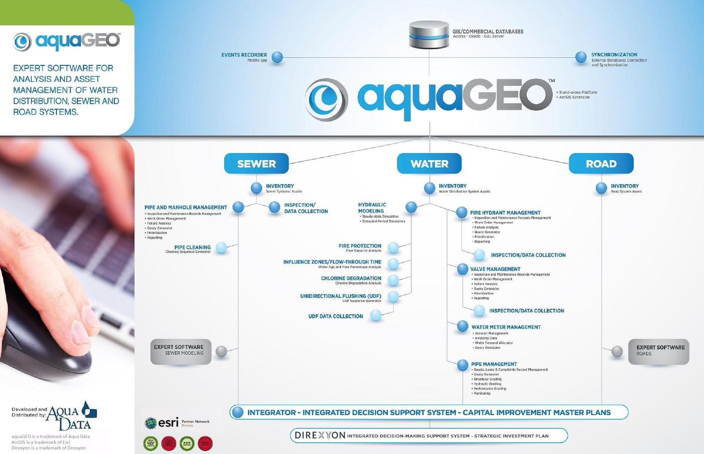
About aquaGEO™
Designed and implemented in 1987, the aquaGEO software (formerly known as Aqua Cad® Suite) is dedicated to the diagnosis, analysis and management of the state of water systems, to sewers and roads.
Experienced by customers and evolving, this expert system integrates these infrastructures by providing a modular basis that meets the needs of both municipal engineers, public works managers, heads of geomatics and engineering consulting firms.
Available as standalone platform or as an extension to ArcGIS.
MODULAR PLATFORM
CLICK TO DOWNLOAD PDF VERSION
OUR PARTNERS